
On the way on the HeimatSpur Celtic circular route
I'm on my way - are you going with me?
Mystical paths are my great passion. The Vulkaneifel is full of them and on the website of the GesundLand Vulkaneifel I find under HeimatSpuren I immediately find a trail that arouses my curiosity. The description of the Keltenrundweg promises me exactly the atmosphere I like so much. In advance, I downloaded the exact hiking route to my cell phone, which is quite easy with the help of the QR code on the GesundLand hiking map.
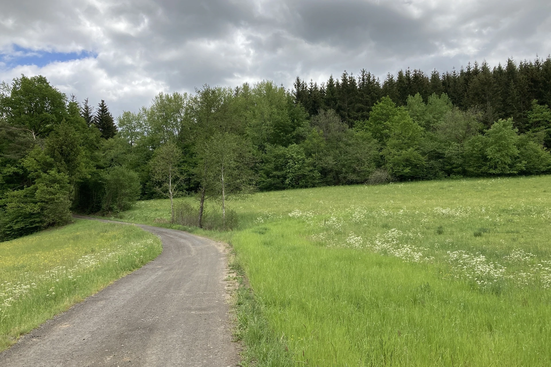
The starting point of the hike - the parking lot of the Vulcano info platform in Steineberg - is well signposted. My hike begins on an asphalt path above the village. I quickly leave the last houses of the village behind me, and it feels as if I have already reached the first highlight of the hike: The path leads through cornfields and meadows over a landscape plateau with a fantastic view. In front of me the view reaches as far as the Hunsrück, behind me the view goes far into the Eifel. The green fields, the colorful flower meadows, the blue sky over which the clouds are chasing, look to me like painted, with perfectly coordinated color combinations. I can well imagine that people settled here very early in history. I let this broadening of the horizon take effect on me for a bit before I resume my hiking pace. The signposts - the letters KE in white on a green background - are so far regular and clearly visible.
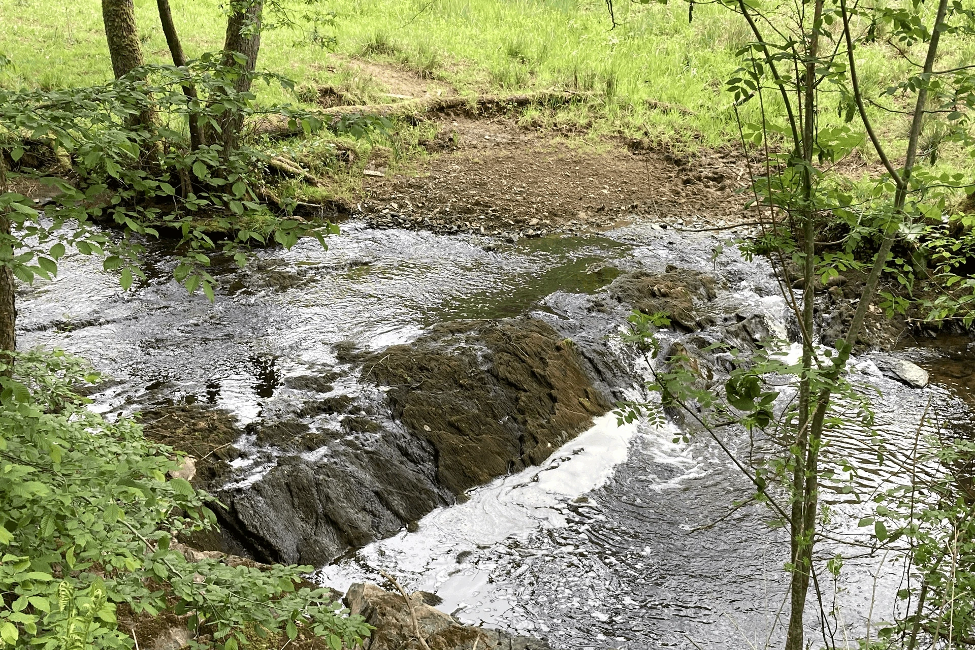
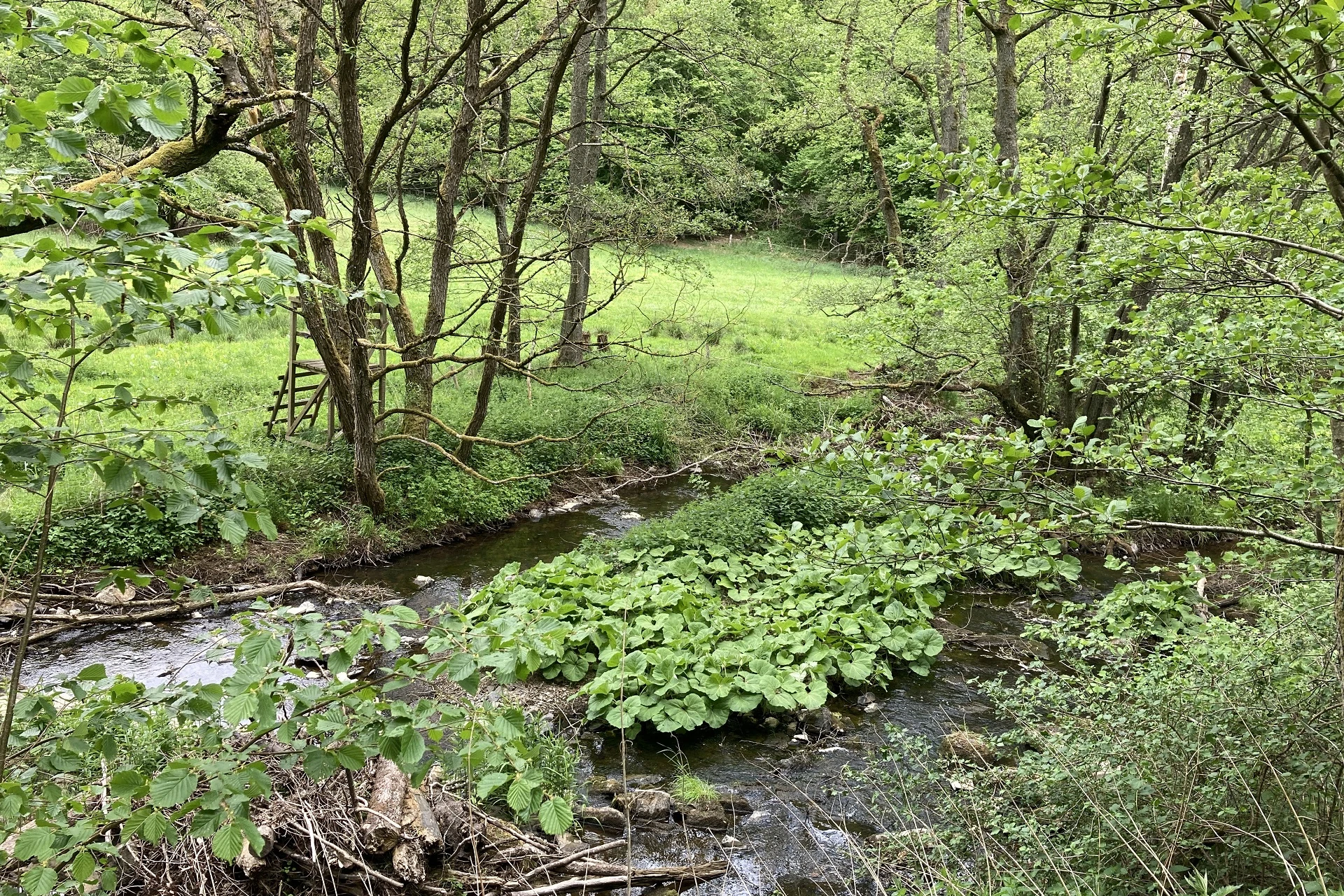
The path leads downhill, briefly through a patch of forest, then past meadows and fields again. I like to hike very much downhill, even if it is already clear to me that sooner or later it goes uphill again. On this tour, the ascent should be later...freely according to the motto: The later, the more! After about five kilometers I now walk through the forest, accompanied by the Ueßbach to the left. Behind the stream are wide meadows where cows and sheep graze peacefully. On the right, impressive slate walls covered with moss and ferns appear again and again. I am sure, in the small caves between the stones elves and goblins must live...The pine forest has suffered quite a bit under the last storms. Meter after meter of wood is piled up on the roadsides.
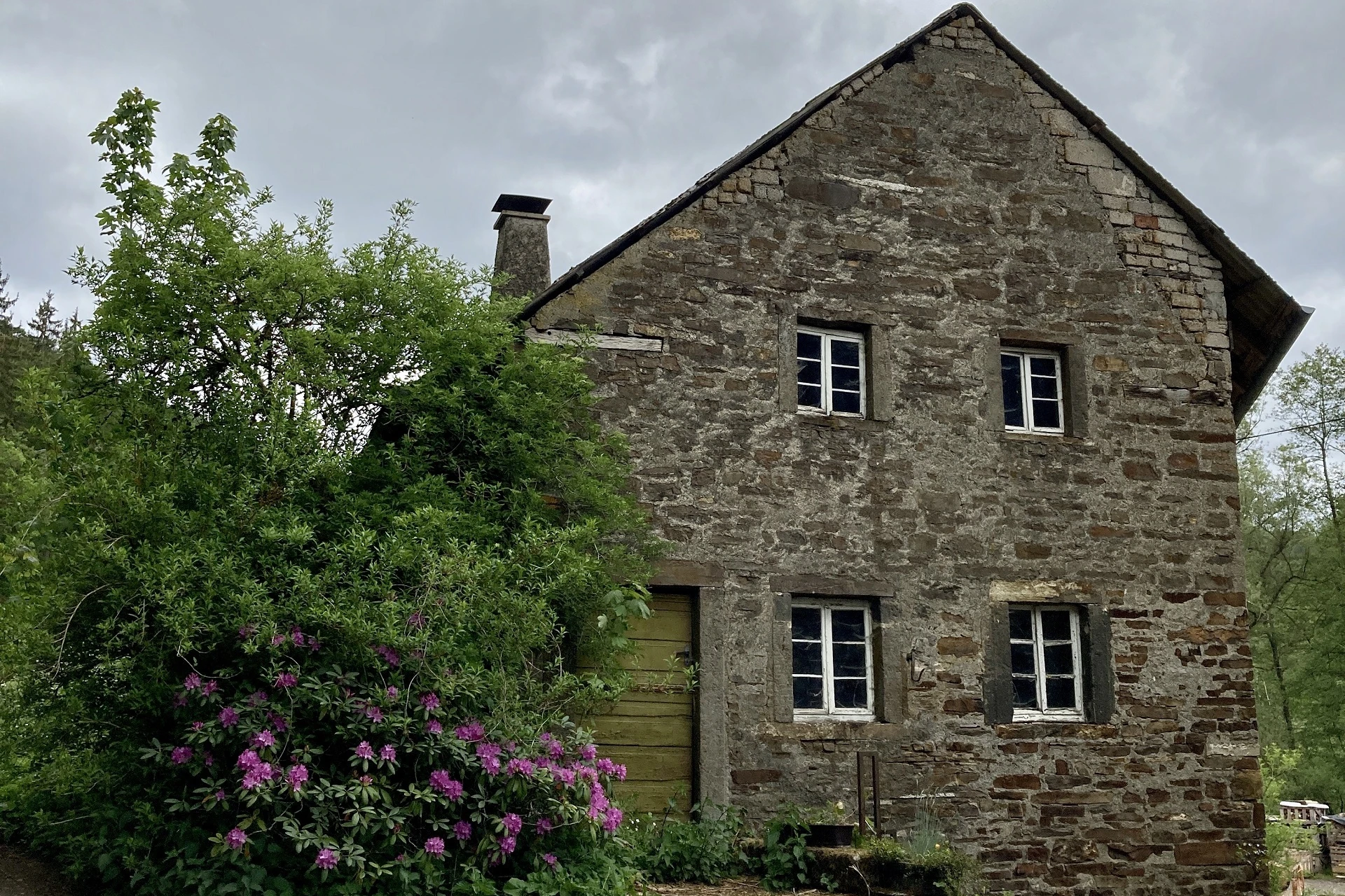
Arrived at the Demerath mill, the mill dog wants to greet me stormily, but the mill owner whistles him back. The dog trots back to his master with his head hanging down. I look around a bit. The mill was built around 1500 and used to serve as a ban mill. There, a persecuted person was granted six weeks and three days to stay and be safe from the protection of the persecutors. A beautiful place with a long history.
After about nine kilometers I leave the Ueßbach valley and the path crosses a county road, but after a few meters the path turns left into a forest. Mighty oaks and beeches cast their shadows on the path. The Celts revered them as sacred trees. The oak was a sign of vitality and strength, the beech was the tree of intuition. Maybe that's one reason why I'm still full of verve on the trail, even though the cloud cover is slowly getting thicker and the air is muggier.
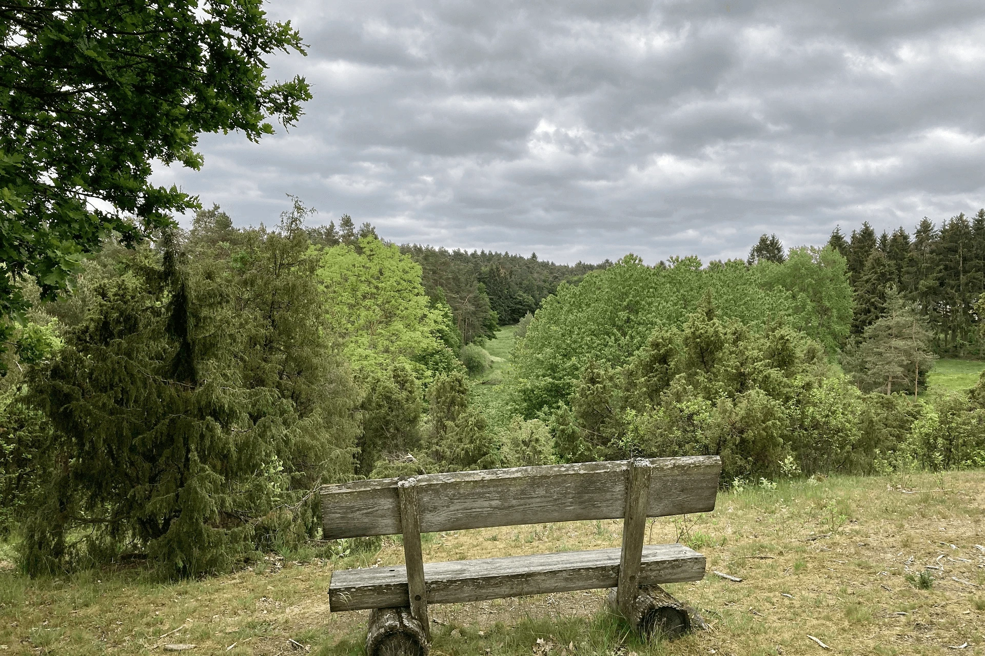
After a total of ten kilometers, I take my lunch break on a beautiful bench and enjoy the cheese and tomatoes really well. Since I have discovered so far no possibility to stop, I am glad that I have enough water with me. Rising wind shortens my break. I throw on my hiking jacket and continue. After about two kilometers a sign shows me the way to the nature reserve Wachholderheide Geisert.
Just before the first juniper bushes appear, I discover a very special tree to the left of the path. An old oak stretches its canopy far and high above me. How well I can understand that the Celts saw something very special in the oaks. Arrived in the Geisert, I sit down on a bench under oaks and let this place work on me. In front of me is bush after bush of juniper and the air carries the spicy scent to me.
Today we associate juniper with gin, but our ancestors, the Celts, revered it as a magical tree whose magical power was said to cross the boundary between life and death. Thus, the Celts smoked berries and needles in the immediate vicinity of the dying, in the hope that death could still be dispelled with it. Even today, the dried berries are smoked to cleanse rooms and the essential oil of juniper has a calming effect. So relaxed and grounded, it's no wonder I find it hard to leave this place behind, but I already have the next highlight of the trail in mind. And I am not to be disappointed.
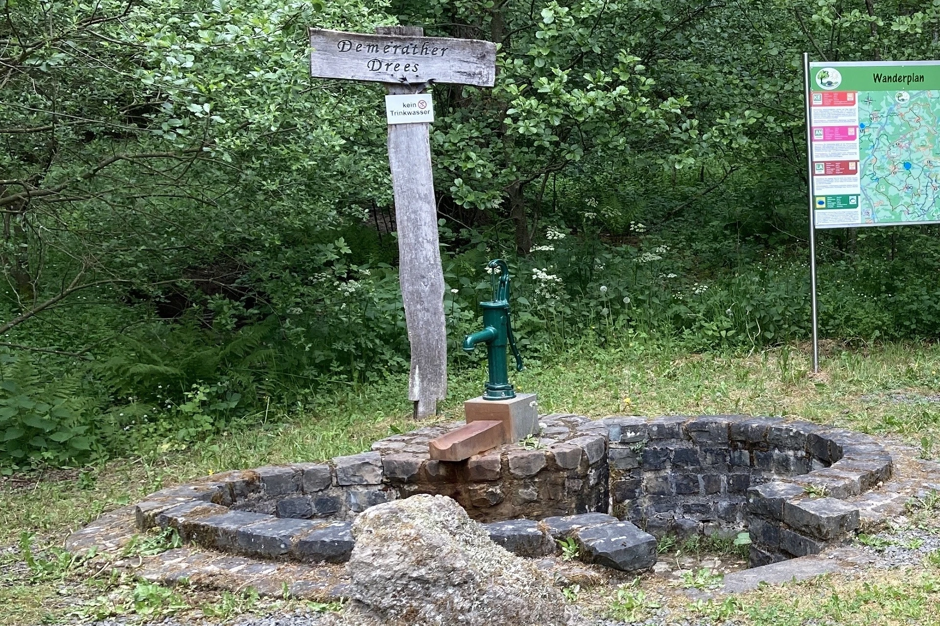
Only about 500 meters further lies the Demerather Drees. The name Drees stands in the Eifel for springs containing iron and minerals. This spring here, which the Celts called Thriasan, brings forth mineral-rich and carbon dioxide-rich water deep from the earth. The water used to be used as a leavening agent in baking. The Demerath housewives get their Welkisch Kniedeln - buckwheat dumplings in High German - particularly well. When you press the pump, the smell of the high iron content immediately hits your nose. I wouldn't want to drink it under any circumstances, but the water is wonderfully cool and refreshes my hands and arms. And exactly this refreshment benefits me from kilometer 13.
Here the path rises within one kilometer from 426 to 503 meters in altitude and for the first time I am quite happy that the thermometer does not show 25 degrees today. At the top, the trail briefly crosses the county road and from here it goes slightly uphill under trees to the finish. Suddenly the forest becomes denser again, the light more diffuse and in the midst of this mystical atmosphere I have reached the Steineberger Ley with its Celtic ring on the hilltop. Here I switch off the route planner and let myself drift. This mountain was formed by volcanism and is millions of years older than the maars of the volcanic Eifel. With an unimaginable released energy it came out of the middle of the earth. At 558 meters, it forms a high plateau from which one can see far into all parts of the country between the trees. It is not surprising that the Celts built a fortification here around 500-100 B.C. to protect themselves from enemies. There is a signposted circular route on which the exact location of the ring wall is described at various stations.
In between, I let these stone ramparts have an effect on me again and again. This twilight under the sacred trees and the silence that surrounds me here are truly mystical. A good hour I explore this place, meditate on a bench and discover from there a group of three basalt stones of different sizes. The largest stone in the middle particularly catches my attention. I place my hands on the soft moss with which the stone is covered. My gaze wanders upward toward the treetops, and on a tree trunk I discover a sign that reads "The Sacrificial Stone." According to tradition, this stone is known as the sacrificial stone or sacrificial site. Goosebumps cover my arms. I wonder what it was like when the Celts lived here?
Arriving at the end of the Celtic Ring, the forest thins out and I am standing directly in front of the Vulcano viewing platform, the 28-meter-high observation tower. Unfortunately, access to the tower is currently closed because one of the outer Douglas fir trunks supporting the tower is not in good condition. Very unfortunate, because that would certainly have been the crowning glory of this round. But the tower is also an impressive sight when viewed from below. From here it is only a few hundred meters to the starting point of the tour.
My conclusion about this circular hiking trail: A very varied route over a plateau and through forests and wide valleys. The historical background of this tour has particularly appealed to me and I was not disappointed. Due to the good signposting, the round can also be done very well without a navigation device. Be sure to take enough food with you. On a hot summer day, I recommend starting the tour very early in the morning.
After the hike is always before the hike - Tanja op Jück
Author: Tanja Otto
 from valerie schneider
By submitting the form, you agree to our privacy policy.